
A Window Into Quincy’s Past: Rare Henry Lewis Lithograph Preserves One of City’s Earliest Views
Created from sketches made before the Civil War, Henry Lewis’ depiction of Quincy captures a young river city rising above the Mississippi at a moment when steamboats were helping transform the community.
QUINCY, Ill. Long before photographs documented Quincy’s riverfront, before the city’s bridges crossed the Mississippi and before many of its most recognizable buildings existed, an English-born artist stood along the river and recorded what he saw.
The resulting image offers a remarkable glimpse of Quincy as it appeared nearly 170 years ago.
A scarce hand-colored lithograph by Henry Lewis, appearing as an individual sheet in the auction market, is part of Lewis’ celebrated Das illustrirte Mississippithal, an ambitious series documenting communities, landscapes and everyday life along the Mississippi River during the middle of the 19th century.
Among the collection’s images is “Quincy, Illinois,” an expansive view showing the developing city across the river, with steamboats and other vessels occupying the Mississippi in the foreground.
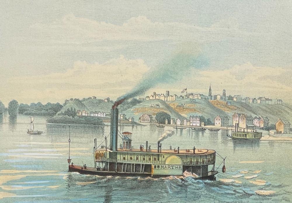
For modern viewers accustomed to photographs of Quincy’s riverfront, Lewis’ work provides something very different. It is a view of the city before the Civil War, captured while the Mississippi remained the community’s defining transportation corridor.
Quincy Before the Bridges
The Saint Louis Art Museum maintains an original example of Lewis’ “Quincy, Illinois” in its permanent collection.
The museum dates the color lithograph to 1854-58, although Lewis’ original Mississippi River sketches were made several years earlier. The Quincy image measures only about 5 7/16 inches by 7 3/4 inches, making the amount of detail packed into the scene particularly striking.
The scene looks westward toward Quincy’s bluffs, with the settlement spreading across the elevated landscape beyond the river.
The Mississippi dominates the foreground.
Steam-powered riverboats and other vessels reinforce what the river meant to Quincy during the 1840s. Before railroads fully transformed inland transportation and decades before bridges physically connected Quincy with Missouri, the Mississippi served as the commercial highway linking the city to St. Louis, New Orleans and communities throughout the expanding American West.
Lewis captured Quincy at precisely that moment.
It was a community developing quickly enough to warrant inclusion alongside some of the best-known cities on the Mississippi.
Two Quincy Views in a Monumental Collection
Quincy was important enough to receive not merely one illustration in Lewis’ project, but two consecutive plates.
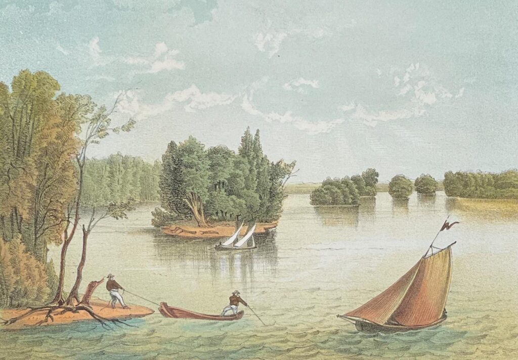
The St. Louis Public Library’s Rare Books and Special Collections holdings identify Plate 52 as “Quincy, Illinois” and Plate 53 as “A View on the Mississippi Near Quincy.” They appear between Lewis’ image of his own riverside encampment and his views of Keokuk and Hannibal.
The Saint Louis Art Museum also owns an original example of View on the Mississippi near Quincy, dating it to 1854-58. The museum describes Lewis’ work as unusually authentic documentation of the Mississippi and its communities during the era of westward expansion.
Together, the two prints provide an extraordinary visual record of the Quincy area during the late 1840s.
That makes them more than decorative antique prints. They are historical documents.
An Artist Traveling the Mississippi
Henry Lewis was born in England in 1819 and immigrated to the United States as a child.
During the 1840s, he traveled extensively along the Mississippi River, making sketches of communities, landscapes, river traffic and people he encountered along the way.
His Mississippi journeys between roughly 1846 and 1848 supplied much of the source material for the enormous project that followed.
Lewis first transformed his observations into a gigantic moving panorama.
The Saint Louis Art Museum describes the traveling panorama as a way of bringing art and distant American landscapes to audiences who might never have the opportunity to visit galleries or travel the Mississippi themselves. Lewis selected scenes ranging from Fort Snelling in present-day Minnesota to communities much farther south.
The sketches were eventually converted into lithographs for the publication that made Lewis’ views enduring pieces of American visual history.
The Illustrated Mississippi Valley
Lewis’ German-language work carried the imposing title Das illustrirte Mississippithal, dargestellt in 80 nach der Natur aufgenommenen Ansichten vom Wasserfalle zu St. Anthony an bis zum Golf von Mexico.
Loosely translated, it presented the Mississippi Valley through views taken from nature, stretching from the Falls of St. Anthony to the Gulf of Mexico.
The work was published in Düsseldorf during the 1850s by Arnz & Co. It was released in installments rather than as a single volume, one reason complete surviving examples have become scarce. Bibliographic records indicate the publication contains 78 lithographic plates, with the large folding New Orleans panorama accounting for two of the 80 views advertised in the title.
Lewis documented a remarkable cross-section of the river.
The collection includes views of St. Paul, Dubuque, Nauvoo, Warsaw, Quincy, Keokuk, Hannibal, Alton, St. Louis, Memphis, Vicksburg, Natchez, Baton Rouge and New Orleans, along with river landscapes and scenes depicting Native American life.
The St. Louis Public Library’s collection provides a nearly complete geographic journey down the Mississippi, with Quincy occupying an important place near the center of that visual narrative.
A Book Collectors Have Pursued for Generations
The individual Quincy lithograph is collectible in its own right, but complete copies of Lewis’ book occupy another level of the rare-book market.
Auction records show a complete first edition sold through Bonhams in 2010 for $61,000. Another example offered by Bonhams in 2021 realized more than $56,000, illustrating the continuing demand for the work among collectors of Americana and Mississippi River history.
Auction catalogs and bibliographers have long regarded the work as one of the important illustrated records of the pre-Civil War Mississippi Valley.
Part of its significance comes from timing.
Lewis was not looking backward nostalgically at a vanished river culture. He had actually traveled through these communities and made his sketches while that world was unfolding around him.
When he drew Quincy, the scene in front of him was contemporary life.
Today, it is history.
Quincy Frozen in Time
Perhaps that is what makes the Quincy image so compelling.
Lewis could not have known what would eventually occupy the bluffs before him.
He could not have seen the bridges that would cross the Mississippi, the factories that would line portions of the riverfront, the railroads that would compete with the steamboats, or the neighborhoods that would eventually spread far beyond the compact city depicted in his work.
He simply recorded Quincy as it appeared.
The result preserves a community still closely tied to the river that created much of its early prosperity.